Challenges of Tracking Birds
A message from Ana to everyone:
Dear Tom, Mark, Marie and Jaime
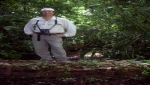
I am monitoring the birds each 2 days. Each day the things are gettingworst. I am spending more than 14 hours in the field and it is not all the time that I can find all of them. Today I didn’t find 6 of them. I am very disappointed with this. Now I can understand why this bird has never been studied.

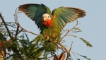
Flock of Slender-billed Conures © Photo M Stafford
They don’t seem to have a pattern (no direction) and move a lot in the landscape for the range covered by the transmitters. I am worried about the next weeks and also days. I am doing the best that I can. I am moving a lot to try to find them. I also bought a car for that!
I really would like your opinion about this situation, hoping we can find the way to solve this challenge.
All the best,
Ana
Message from Tom White to Ana
Dear Ana,
First….”welcome to the world of wildlife telemetry”!! What you are experiencing now is something that everyone who has ever done telemetry on highly mobile animals knows all too well….it’s not easy!
Having said that, there are a few things that may help. Use what you already know about the birds, such as what they eat and their need for stands of trees for roosting, to try and “predict” where they may go next.
For this, GoogleEarth will be of great help. Using a large-scale image of the parrot’s area of use, plot out the known parrot locations the best you can and see what types of areas they have been using, and when and in what time sequence. Then, look for similar areas across the landscape in increasing radial increments out from where the birds were initially caught. One thing is certain: the birds are occupying space somewhere.
They have biological needs that dictate where they go and what they do….use this to your advantage.
Also, given that you know the average reception range of your telemetry equipment is about 3-4 km, use this distance to “buffer” areas around selected strategic points throughout the landscape. In this way, you can maximize your efforts and cover the maximum area possible, given the limits of your primary resources (time and gasoline). Further, do not discount the possibility that the birds could return to a given area days or weeks after having left. Parrots are superb “resource trackers”, and respond very quickly to changes in food availability. At this point in their life cycle (post-breeding), food acquisition, both for the adults and especially juveniles, is the driving force behind their movements. Follow the resources….think like the parrots!
One more thing……telemetry range is somewhat greater at night. The birds will also be stationary and perched up in trees (hence higher and off the ground) at this time. Again, using GoogleEarth, target areas with good stands of pellines (or other dense growth) that could serve as good roost sites. For this, use what you already know about where the birds have been roosting up until now. Have they been roosting in areas near bodies of water? Near wheat fields? Do they tend to avoid areas with lots of houses and human activity? These are just some examples of the types of questions you should be asking yourself as you search. Remember, animals seldom - if ever - use their environment in a truly random fashion. If you don’t see a pattern….maybe you’re not looking at “their world” at the same scale as they do.
One final note….although I’m sure you will, do take a friend or fellow student with you when doing a lot of night telemetry, for your own safety.
Vehicles have a way of breaking down in the worst of times and places…!
Remember…..this happens to all of us who track wild animals…….DON’T GET DISCOURAGED!!!
Tom